News Watch
Data transfer flowing both ways
Resulting from Bentley’s Cesium acquisition.
News Watch
Trimble reports first quarter 2020
Trimble’s financial report demonstrates stability in hard-hit markets…so far. Trimble’s results for the first quarter of 2020 look almost as ...
Archives
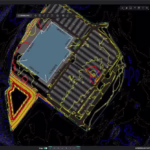
Cesium Consortium offers open source virtual globe technology
Bentley Systems is the first company to sign up for the consortium. Many companies don’t consider Google Earth a suitable tool for ...
Archives
Earth Volumetric Studio visualizes time dimension in 3D PDF’s
Including naturally transitional data or engineering changes will aid any geospatial or earth-engineering inquiry. C Tech Development Corporation (CTECH) has ...

Archives
Construction, geospatial finding their way in virtualization
Data is needed everywhere, and virtualization is the new transport. A report from the recent Virtualize Conference. By Kathleen Maher ...
Archives
VTS wins patent for 3D PDF geospatial reporting
New technology makes it easier to distribute large 3D maps. UK software house Visual Technology Services (VTS) has been awarded ...
Archives
Hexagon extends geospatial reach by acquiring MicroSurvey Software
The Canadian vendor of desktop and field software is both an Autodesk and IntelliCAD developer. Swedish technology conglomerate Hexagon has ...
Archives
New Bentley apps opens AEC data to broader business use
An ODBC driver opens AEC data to Excel, Crystal Reports, and other products. Other apps extend AEC data beyond design ...
Archives
Planar announces 23” 3D-ready monitor for occasional user
Oregon-based Planar Systems is hoping occasional users of technical 3D, such as management in geospatial or mechanical engineering, will be ...
Archives
Apple Quietly Assembles Geospatial Brain Trust
Apple has quietly acquired the development teams of two small geospatial software companies, in an apparent bid to create a ...