News Watch
Lidar for everyone
Didn’t it seem like we’d all be measuring playing fields, creating 3D objects, and making virtual 3D playgrounds out of ...
Archives
Bentley Systems and Trimble team up for construction modeling
Pooling resources and sharing opportunities to advance construction BIM. Bentley Systems and Trimble have been forging links between their products ...
Archives
Autodesk acquires Allpoint for 3D LIDAR expertise
The founder and key researchers will join Autodesk’s Reality Capture team. The technology they bring has its roots in computer ...
Archives
Redefining production in the age of Digital Reality
Software is transforming every stage of the manufacturing process. Small companies with niche technologies are being gobbled up. By Kathleen ...
Archives
3D laser map shows earthquake zone before and after
High-res LIDAR scans reveal previously undiscovered relationships between smaller faults. Geologists have a new tool to study how earthquakes change ...
Archives
MIT team invents cheap way to add 3D cameras to cellphones
A one-pixel pulse is tricked into decoding 3D data. Qualcomm is taking a close look. [Editor’s Note: A video explaining ...
Archives
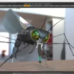
Modding the Xbox Kinect to gather 3D streaming data
In less than a year after its release, a flood of researchers and tinkerers are finding ways to re-purpose the ...