
The latest update to the Cesium SaaS platform is a global layer of the world’s 3D buildings. In addition, Cesium collaborates with Epic to make geospatial data available within Unreal Engine.
![]() Cesium, as we have written, provides a platform for 3D GIS data which are organized as Global Base Layers and include worldwide data for terrain, aerial imagery, and streetmaps. Now the company has added on Cesium OSM Buildings, a base layer that includes more than 350 million 3D buildings from all over the world. Cesium is using the open-source data from the OpenStreetMap Project.
Cesium, as we have written, provides a platform for 3D GIS data which are organized as Global Base Layers and include worldwide data for terrain, aerial imagery, and streetmaps. Now the company has added on Cesium OSM Buildings, a base layer that includes more than 350 million 3D buildings from all over the world. Cesium is using the open-source data from the OpenStreetMap Project.
“As digital twins and urban mapping gain momentum in 3D geospatial, we are excited to offer a global layer of 3D buildings that can be easily visualized, styled, and analyzed in an efficient and interoperable manner using 3D Tiles,” said Cesium CEO Patrick Cozzi. “Cesium OSM Buildings will help geospatial developers innovate by giving urban context to 3D applications for a broad range of use cases.”
Cesium OSM Buildings are streamable to any device, thanks to 3D Tiles, an OGC open standard developed by Cesium built to accommodate massive 3D geospatial datasets. The buildings can be used in any compatible viewer, including Cesium’s free open-source offering, CesiumJS.
Cesium says the OSM Buildings will be useful in construction as well as for planning, training, and simulation applications.
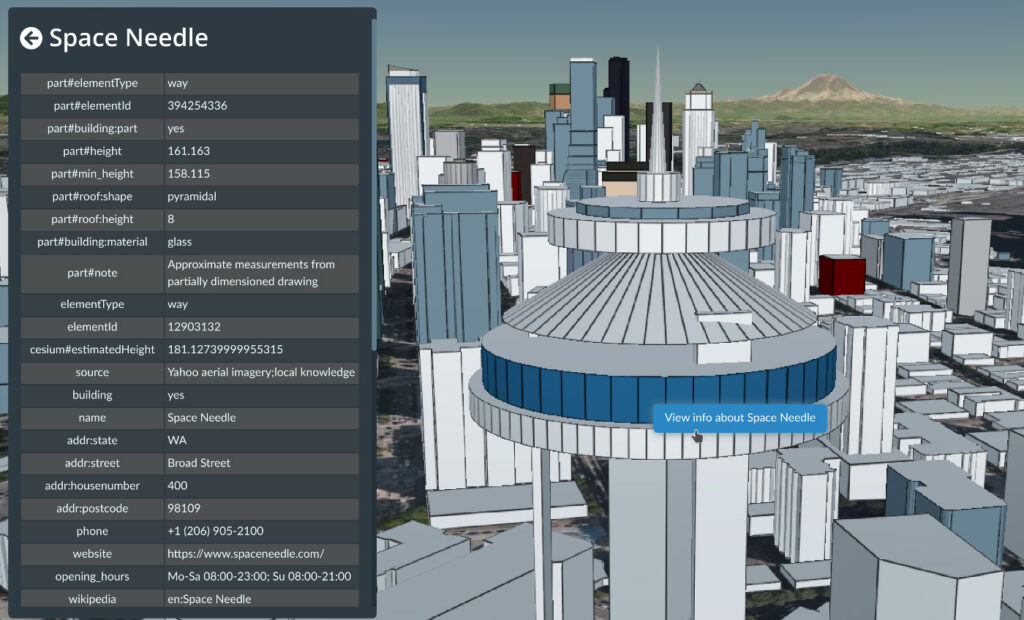
The data provided by OpenStreetMap is regularly updated. Buildings are individually selectable and styleable, and they “clamped” to the terrain meaning that geological features are clearly modeled along with the buildings to provide context for sightlines, shade, barriers, etc. The data includes metadata enabling users to customize the data through color highlights, or adding filters.
In other news
Cesium has been accepted by Epic’s MegaGrants program to build Cesium for Unreal Engine.
Their collaboration is to make geospatial data available to the Unreal Engine via Cesium’s 3D Tile format. Cozzi, Cesium’s CEO, says Cesium for Unreal will have a default connection to the Cesium ion SaaS platform for ready-to-use 3D Tiles of terrain and 3D buildings. Unreal will enable users to use real-world locations captured by satellites and drone for their applications. In addition to game development, Epic and Cesium are seeing the potential for applications in BIM, autonomous driving, AR/VR apps, and content creation.
Cozzi says in his blog post about the deal that he has been inspired by the visual quality of the content created in the Unreal Engine so he’s especially excited by the potential of Unreal’s visualization power married to geospatial data.
What do we think?
The power of the open-source movement has increased exponentially with all the people and organizations who have added on to the vaults of data available. In the case of GIS, companies like Cesium and ESRI have long understood that mutually adding on to the pool of data available only makes for better data and more opportunity. ESRI has offered this paper on the value and uses of open data.