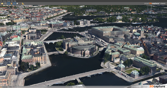
Existing conditions taken with any camera become part of a high fidelity virtual model. Drones are becoming popular for gathering current physical conditions.
Bentley Systems has acquired Acute3D, maker of software for aligning photographs of existing conditions with 3D models to create what Bentley calls reality modeling. The data can come from any photo device from a smartphone to a specialized camera or scanner. Financial details were not disclosed.
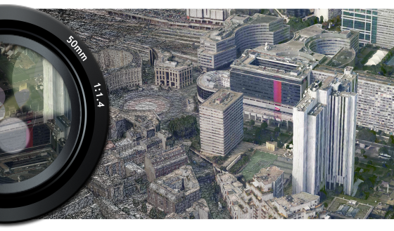
Acute3D’s software takes advantage of recent and rapid advancements in scanning and photography—and especially the recent rise of unmanned aerial vehicles (UAVs) for these purposes—to make the capture of such observations more broadly and continuously affordable.
Acute3D software automates the generation of high-resolution, fully-3D representations from digital photographs taken with any camera, whether highly specialized or embedded in a smartphone.
Bentley says the system is completely scalable “from site to city,” with precision limited only by the quantity and quality of photography. Acute3D technology can assure that existing conditions are contemporaneously considered throughout the architecture, engineering, construction, and operations of any building, plant, or other infrastructure asset.
Bentley Systems Founder and CTO Keith Bentley says, “The world-class Acute3D developers have already achieved two breakthroughs, which remove the barriers to the adoption of reality modeling. First, Acute3D has made it possible for anyone to sufficiently capture existing conditions with just a camera. Of equal importance is the value of the Acute3D result. Rather than a voluminous cloud of discrete points, Acute3D produces a 3D ‘reality mesh’ – intrinsically in the same geometric idiom as engineering models, readily aligning the real-world context.”
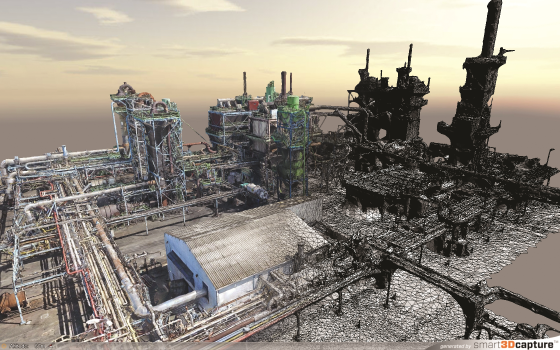
Acute3D was co-founded in 2011 by Dr. Jean-Philippe Pons and Dr. Renaud Keriven, headquartered in Sophia Antipolis (the French “Silicon Valley”). Since its founding, Acute3D has attracted a rapidly expanding user base that includes Nokia, PASCO, and Saint-Gobain, and OEM licensees that include Airbus Group and Autodesk. In China, Internet giant Tencent is working with Acute3D to do large-scale 3D city modeling for several mega-cities, from both aerial and street view photography. Other applications of Acute3D have included existing conditions capture for construction sites, manufacturing facilities, mining operations, pipelines, and oil and gas exploration.
What do we think?
Photo sequences from UAVs (drones) are fast becoming an inexpensive and quick source for surveying, construction monitoring, and inspection workflows. Acute3D’s industrial-level accuracy and unlimited scalability gives its users a leg up on bringing physical conditions into the virtual model.