Archives
PDF3D adds support for drone scans
BY
Randall Newton
The specialist in PDF for science and engineering also adds enhancements for CAD conversion to 3D PDF. PDF3D, graphics conversion ...
Archives
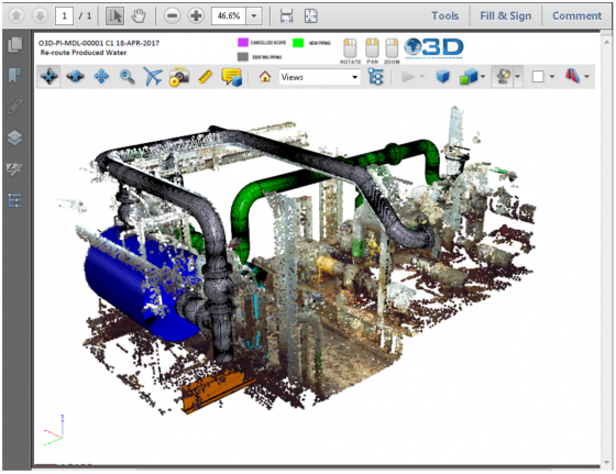
EdgeWise Plant 3.0 runs up to 12x faster with multicore processing
BY
Randall Newton
Other new features include enhanced pipe extraction, QA tools to verify accuracy, and real-time finishing tools. ClearEdge3D this week released ...
Archives
ClearEdge3D wins National Science Foundation grant
BY
Randall Newton
The maker of wicked fast 3D scan technology for feature extraction will work on eliminating blind spots and extending the ...
Archives
AVEVA launches new Laser Modeller to create 3D as-builts
BY
Randall Newton
The new software creates a 3D model in PDMS format based on any leading 3D laser scanner. AVEVA today launches ...
Archives
International Team Completes 3D Survey of Mount Rushmore
BY
Randall Newton
A team of digital preservationists climbed all over Lincoln, Jefferson, Washington, and T. Roosevelt with Leica Geosystems 3D scanners to ...